A Hunt Area is the boundary of ground you want Reckonar to analyze. In this guide you will make one in Scout, the 2D map, by drawing it, building it from mapped parcels or importing a file. Then you will save it and follow its first preparation in Jobs until Field, the 3D workspace, is ready. Pick ground you have walked, so you can test every layer and every Plan against your own experience.
Open Hunt Areas in Scout
Sign in at app.reckonar.com. Scout opens on the map. Pan or search to your ground, then choose Hunt Areas in the rail on the left (on a phone, in the bar along the bottom). Your first time, the list is empty and the panel offers Draw a New Hunt Area.
Draw the boundary
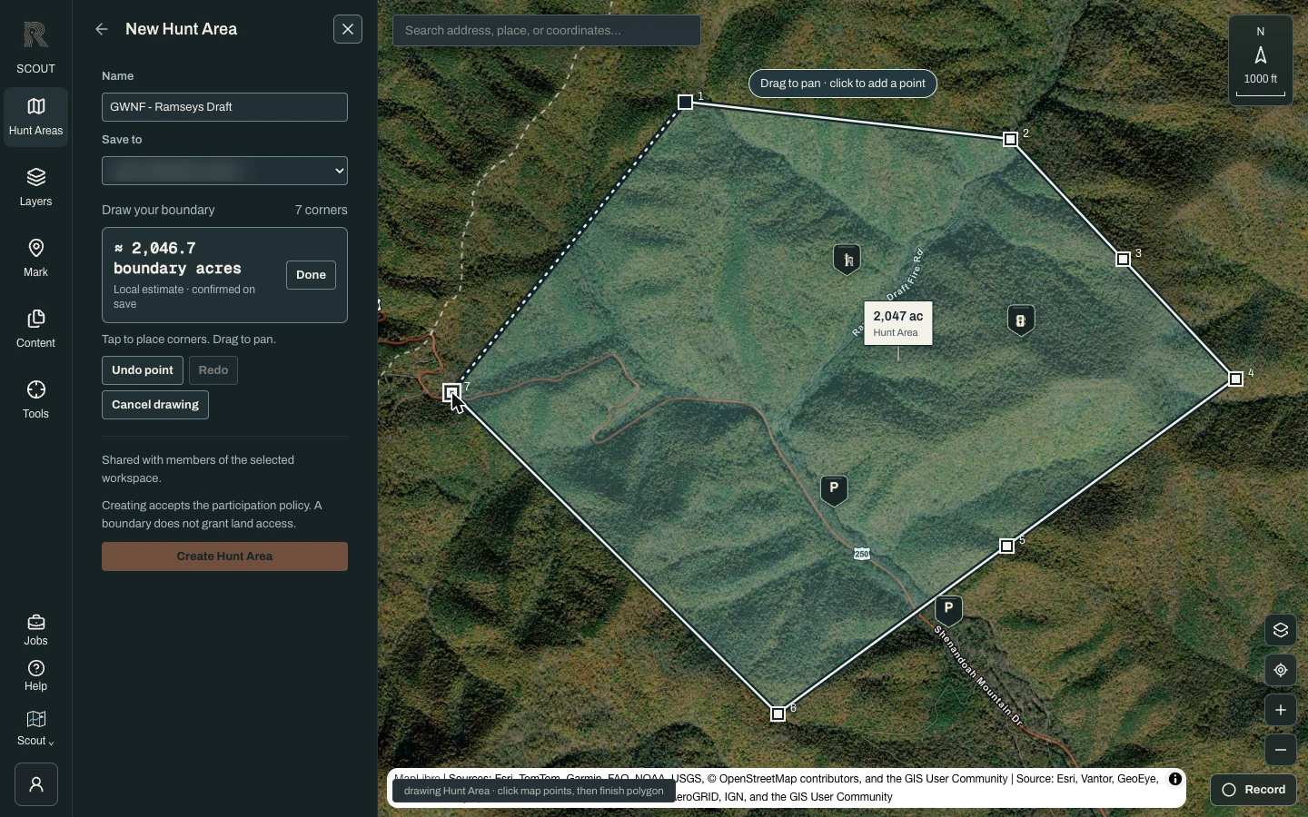
Choose Draw a New Hunt Area. Click the map to place each corner (tap on a phone); dragging pans the map instead of adding a point. Undo point removes the last corner and Cancel drawing backs out. Once you have at least three corners, choose Done. To adjust the shape before you save, choose Edit, then drag a corner.
Or start from mapped land
Parcel and public-land layers cover Virginia, Colorado, Michigan and Georgia today. Open Layers, then Land & access, and turn on a parcel or public-land layer. Click a parcel to select it, and click again to remove it. Hunt Areas then shows how many land features you selected and their acreage. Choose Use for a Hunt Area to start from that selection, or Deselect land to clear it.
Or import a file
Already have a boundary from another app? Choose Mark, then Import GPX, KML or GeoJSON, and Choose file. The file is read on this device, and Reckonar shows how many paths, points and areas it found before anything is saved. Choose Use first polygon as Hunt Area boundary. Back in Hunt Areas, choose Draw a New Hunt Area, which now reads “Resume your draft boundary”, to finish.
Name it and choose where it lives
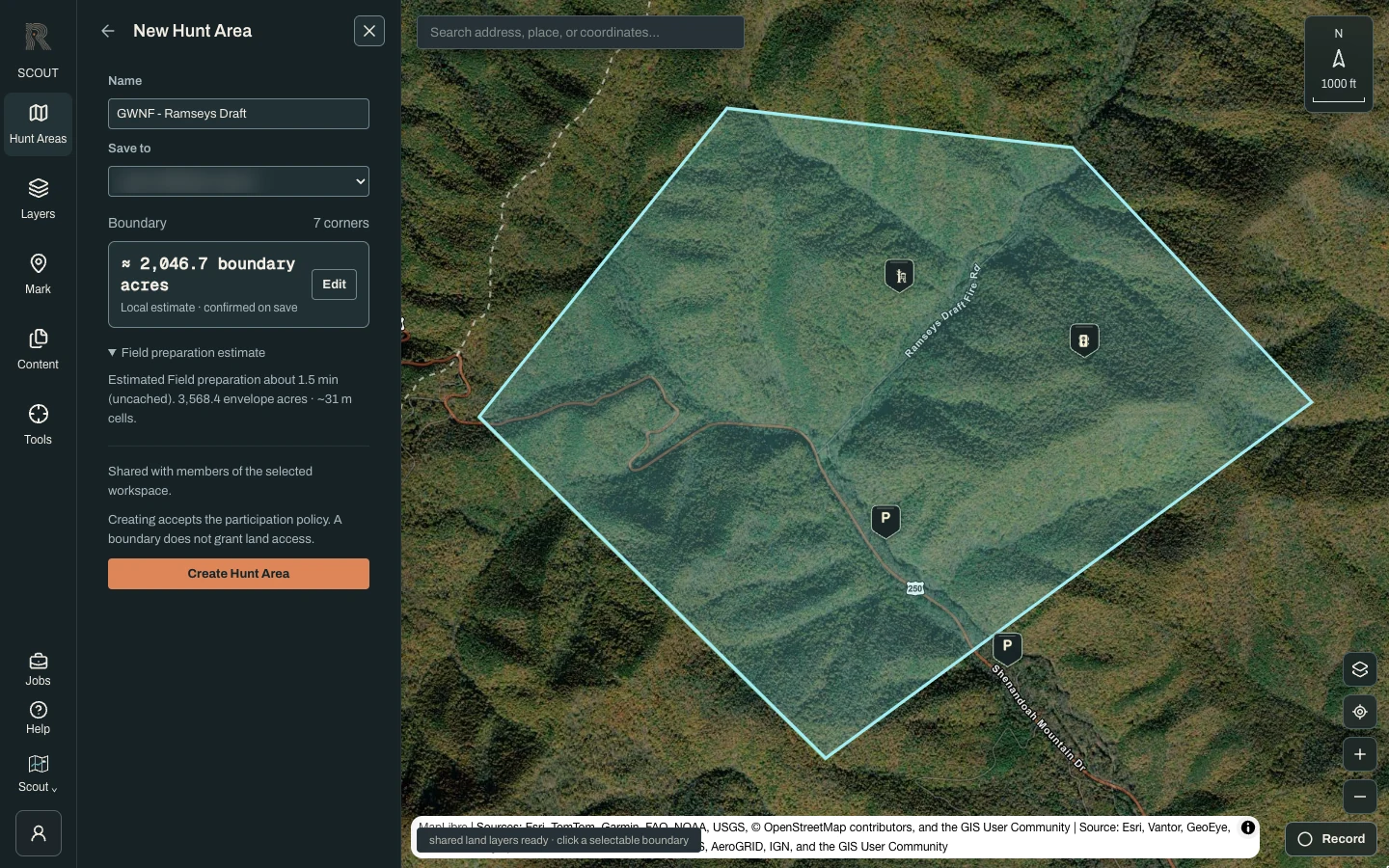
Give the area a Name of at least two characters. Save to sets the owner. Pick your personal workspace, which only you can see, or a Camp where you are an owner or admin. The panel shows an approximate acreage, and Field preparation estimate gives a rough preparation time. When it looks right, choose Create Hunt Area.
Field works on ground up to about 5,000 acres and 12 miles across. It measures the envelope, which is the smallest rectangle aligned to north that holds your whole boundary. A long or L-shaped boundary can have an envelope far larger than its own acreage. If the local estimate is over the limit, the panel warns you, and the server makes the final check when you save.
Follow the first preparation in Jobs
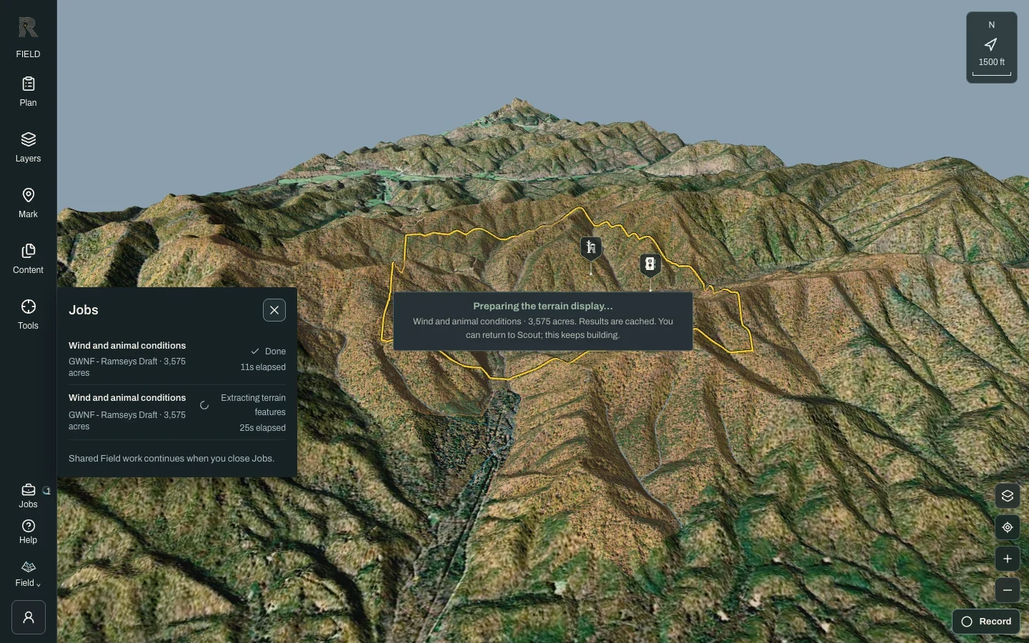
Creating the area takes you straight into Field, which starts preparing terrain, imagery and analysis for this ground. Field shows its progress, such as “Queued · starting shortly” or the stage it is working on. Jobs, in the rail on a desktop and the header on a phone, lists every build with its status and elapsed time. Results are cached, so you can return to Scout while it works. The next visit opens much faster.
Come back to it later
Your area now appears in Hunt Areas. Select its card to fit the map to it. The card then offers Open in Field, a download button for offline use and a settings button. Settings holds Rename, Modify boundary and Manage data. The star pins a favorite to the top of the list. While a build runs, the card says so, for example “Preparing Field…”.
- A boundary is not landowner permission. Creating a Hunt Area accepts its participation policy, but it grants no access to land. Know the property lines and the regulations where you hunt.
- Parcel lines are mapped records, not a survey. Outside the four states above, draw or import your boundary.
- Acreage and preparation time in the form are local estimates. The server confirms the size when you save.
- Preparation needs a connection. A ready map does not mean every optional data source is available for your ground.
- On your first visit, Take the guide walks this same path inside the app, and Help replays it any time.