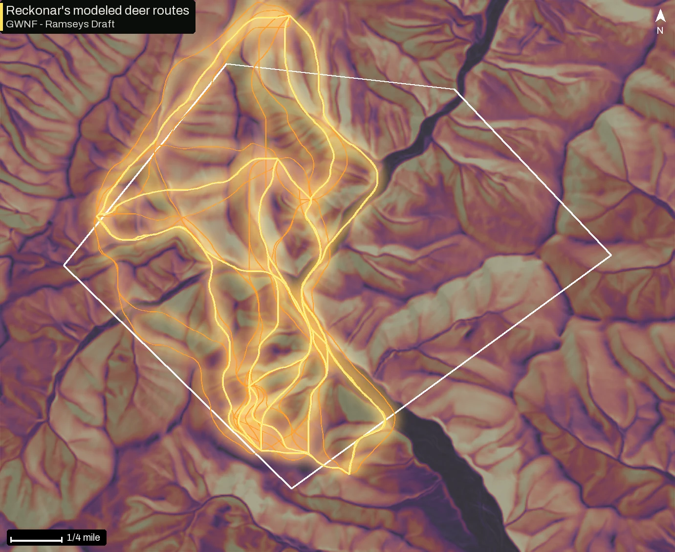
Glass an Appalachian hollow from the next ridge over and you can read the trails. They slide along the side slope, drop into the head of a drainage and cross the ridge at the saddle. You rarely see one go straight up and over a spur.
The short version
- 01Reckonar’s modeled deer routes pay for climbing, priced from measured deer energetics.
- 02On public land at Ramseys Draft in the George Washington National Forest, compared with a naive model, Reckonar’s routes carry about 860 feet of up and down per mile instead of about 1,460, for routes about 16 percent longer.
- 03Where USGS 3DEP lidar covers your ground, Reckonar maps probable old logging roads and benches that the nationwide 10-meter elevation model smooths away.
- 04Your walk in and walk out are planned from your own parking with a human walking model.
Why a deer goes around
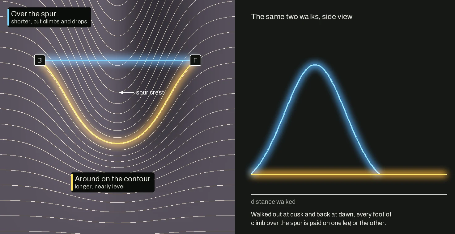
Climbing is the expensive part of a deer’s commute. Measured energetics put lifting the body one vertical foot at many times the cost of a level foot, and a corridor gets walked out at dusk and back at dawn. A pinch point is where the cheap line has nowhere else to go, such as a saddle or a strip of gentle ground between a bluff and a field. A model that treats climbing as free never sees that squeeze, so it can draw a funnel on open hillside that no deer is forced through.
A naive model versus Reckonar
A naive corridor model prices every step by habitat and distance alone. Steep ground costs it no more than flat, so its routes run straight over the top of a spur, and any hunter looking at them would say no deer walks that. Reckonar prices each step by its distance plus the energy of its climb, with habitat still weighing the ground.
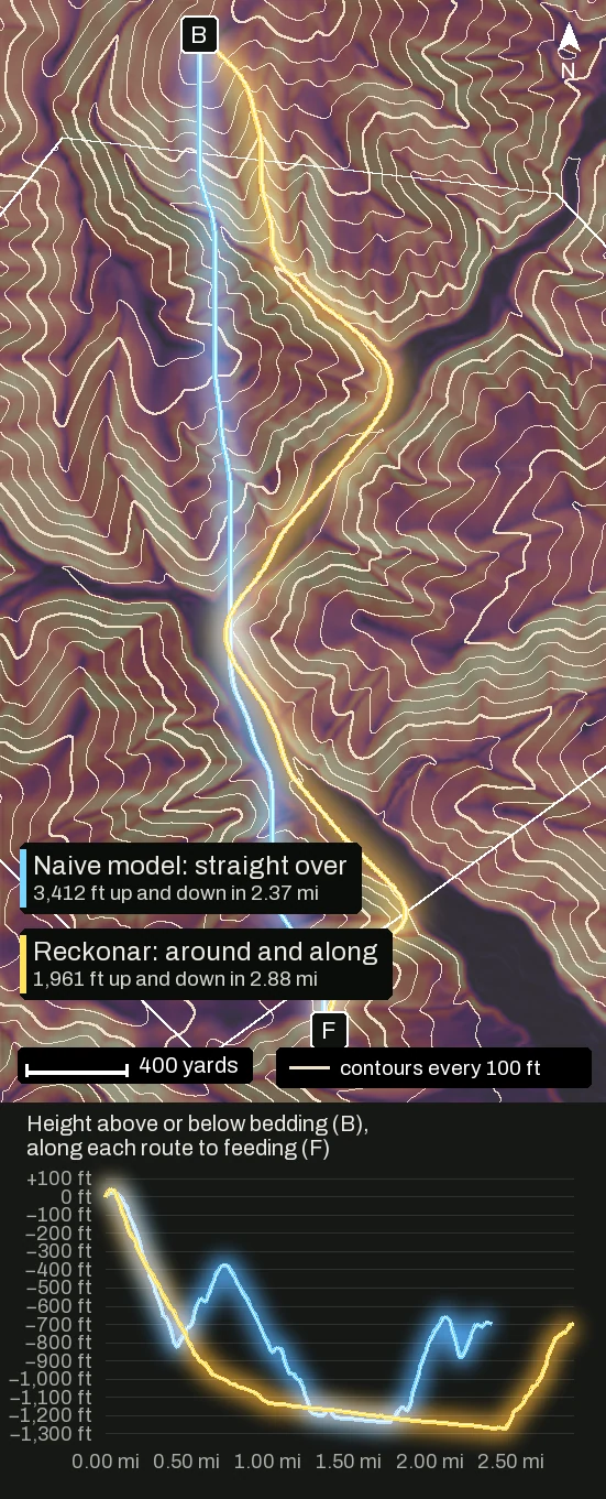
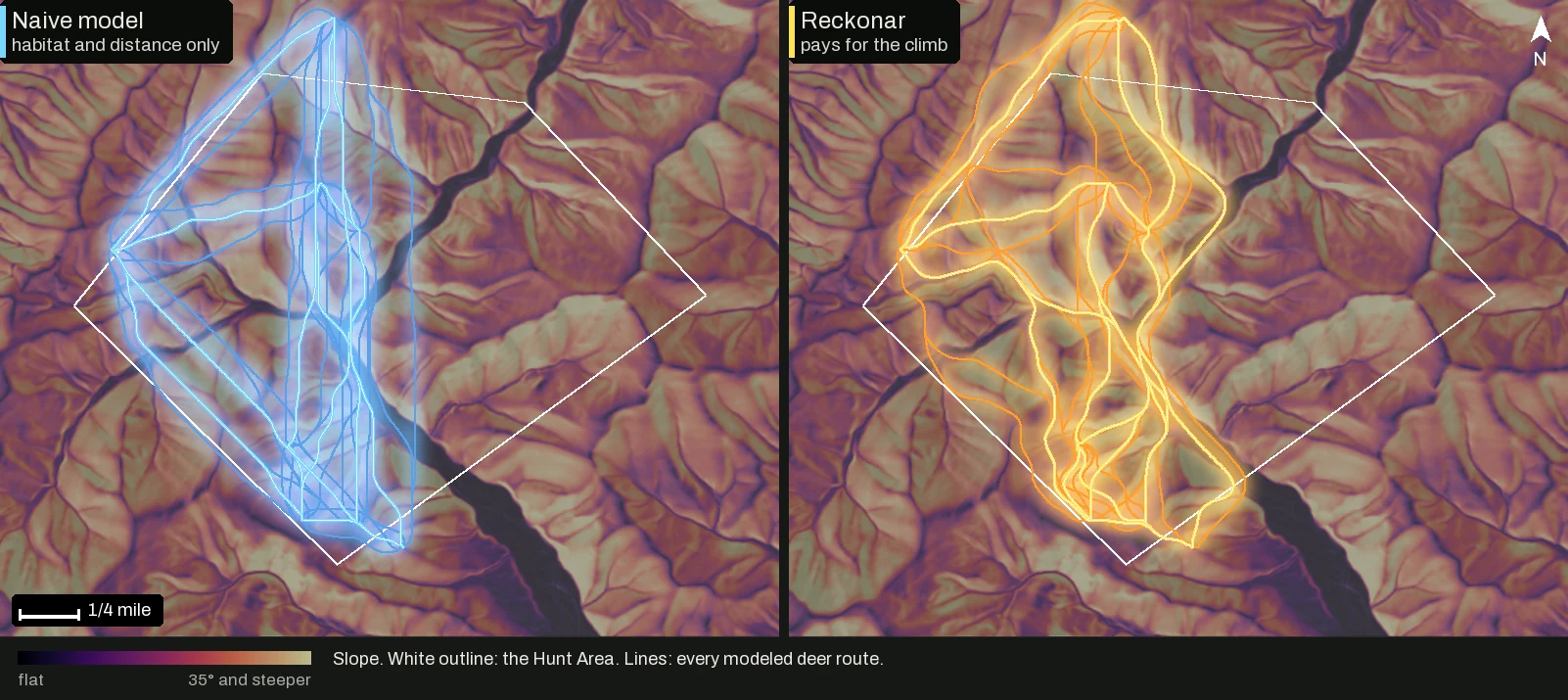
Compared with the naive model, on the 16 bedding-to-feeding connections both models route, Reckonar’s routes carry about 860 feet of up and down per mile instead of about 1,460, and run about 16 percent longer. They spend 28 percent of their length on grades steeper than 25 percent, against 51 percent for the naive model. Lidar covers Ramseys Draft, but its travel surfaces and benches barely move these totals, so the difference here is the energy cost.
Lidar sees ground a 10-meter model hides
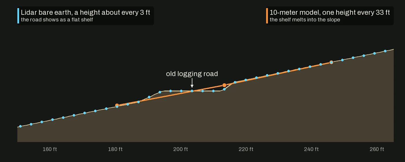
Where USGS 3DEP lidar has been flown over your Hunt Area, Reckonar reads the bare earth under the canopy. It marks probable travel surfaces, narrow low-grade shelves shaped like an old logging road or skid trail, and natural benches with steeper ground above and below. Both make a deer’s step cheaper and your walk a little quicker in the model. Reckonar treats each as a hypothesis, since a road-shaped shelf can be washed out, grown shut or posted.
Your walk in is part of the hunt
A Plan routes every setup from each Parking waypoint you have marked. Its human walking model slows you uphill, in brush and on side-hills, and it plans the walk back from the stand at the end of the sit. The route also weighs where your scent carries, your footstep noise, whether nearby deer could see you, and the ground scent you leave across a deer corridor; that side is its own story in How deer notice you. If you have drawn or recorded the route you actually walk, the Plan leans toward it. The Plan dock shows the walk-in minutes and the route’s miles and feet of climb.
A boundary is not permission
An area you mark Off limits / no shot keeps a Plan from putting a stand in it or a shot across it. A route may still cross it. Routes stay inside your Hunt Area except for a short, flagged leg to parking outside it. A boundary or a lidar road is never landowner permission.
What we don’t claim yet
- Corridors are routes that are cheap in deer energy, not guaranteed deer routes.
- Walk-in times use a provisional pace that has not been fitted to recorded tracks.
Where to find it in Reckonar
- Field › Layers › Plan analysis › Corridors (web), for Prevailing or today’s conditions or a mounted Plan.
- Field › Layers › Terrain mobility · beta, with Natural benches and Travel surfaces where lidar covers your Hunt Area, plus Saddles and Drainages.
- Plan a Hunt with Start at saved parking turned on.
- Mark, to add a Parking waypoint, draw your route in or draw an Off limits / no shot area.
- The iPhone and Android apps do not show Corridors or Terrain mobility yet.