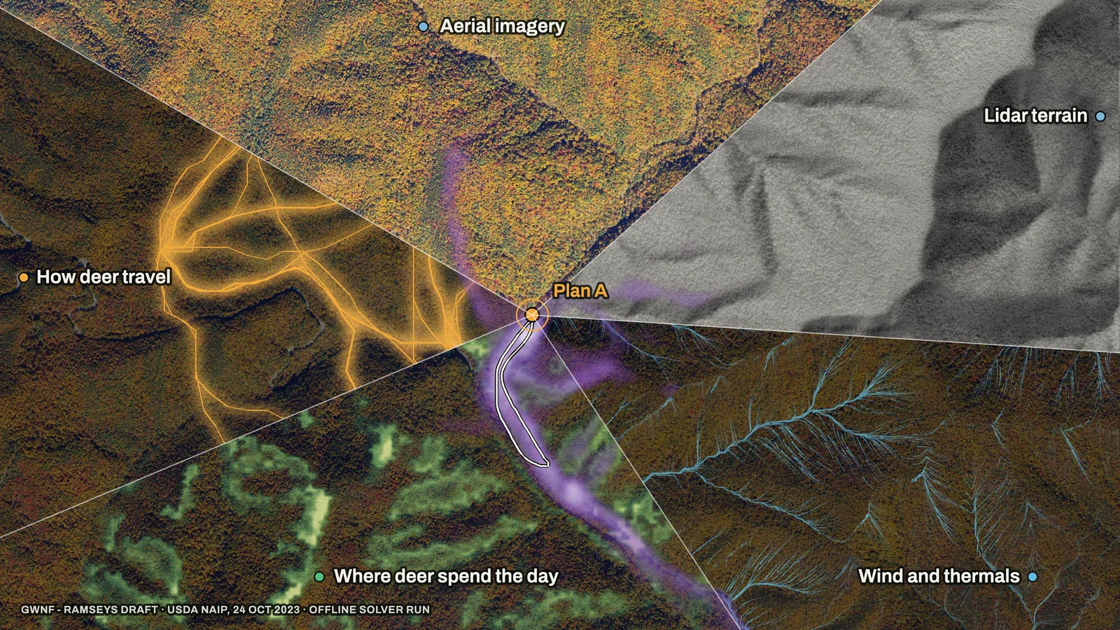
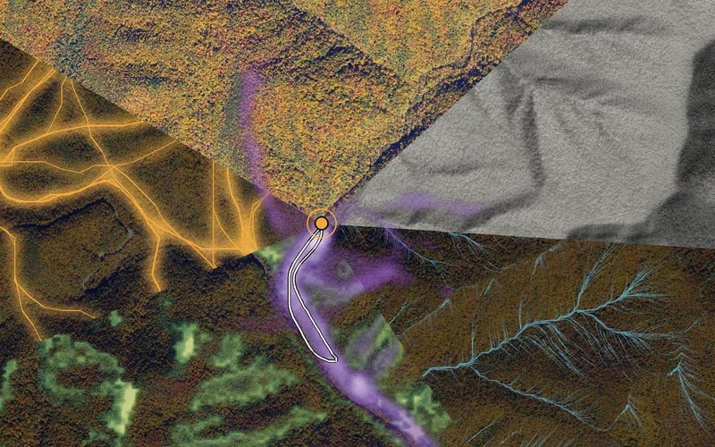
You know a bench where deer bed and a saddle they cross when the wind turns. Reckonar puts maps and numbers behind that kind of knowledge before you walk in: where the wind will take your scent, where deer are likely to be hour by hour, how your walk in reads to them, and which setups give you a clean shot.
The short version
- 01Reckonar is a planning tool for serious hunters. It reads real conditions for your Hunt Area, from lidar terrain to the winds that usually blow there on your dates.
- 02Deterministic solvers do the measuring, from terrain and wind to how deer notice you and whether you have a clean shot.
- 03AI reasons over those results with your own record and expert whitetail scouting principles. It never calculates a number.
- 04Every decision is yours. Reckonar plans before and between hunts and never shows where a deer is right now.
It starts with your ground
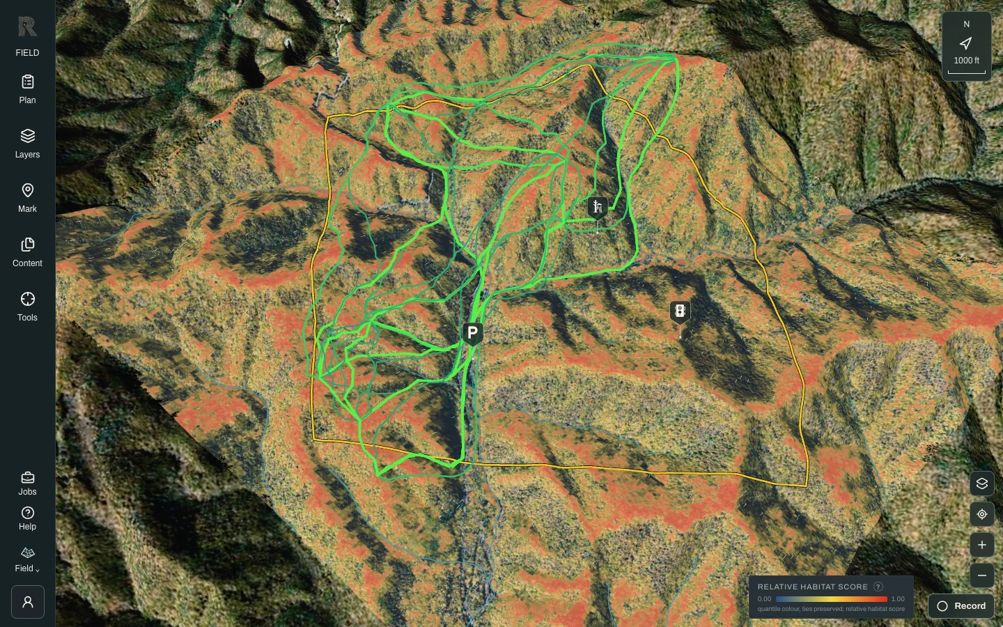
When you draw a Hunt Area, Reckonar prepares that ground on its own terms. Terrain comes from USGS 3DEP elevation and lidar, imagery from NAIP, and vegetation from the LANDFIRE and NLCD maps. Add the sun’s path for your dates, public-land boundaries, NOAA forecasts and the wind history of nearby weather stations, and every layer you see in Field is computed for that ground rather than borrowed from a template.
Solvers do the measuring
A solver is code that turns physics or biology into a map. Given the same inputs it returns the same answer every time, which is why the numbers in Reckonar come from solvers and never from a language model.
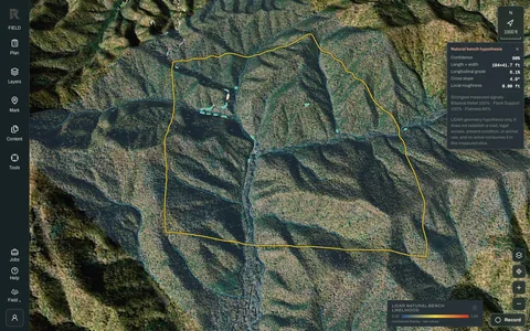 Terrain features find ridges, saddles, benches and drainages, and how hard each slope is to cross.Guide: Read your ground in Field →
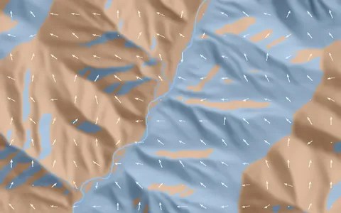 Wind and thermals bend the prevailing wind over your terrain and turn it uphill or downhill as the sun reaches each slope.Thermals follow the sun, one slope at a time →
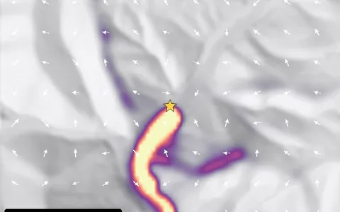 Scent follows that air from every step of your walk and from your stand.How a deer notices you →
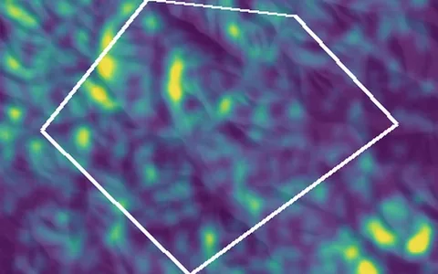 Where deer spend the day scores bedding, feeding, water, travel and security, then follows the daily rhythm hour by hour.Read the deer-day post →
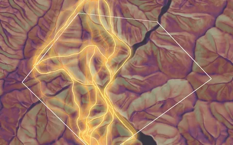 How deer travel draws corridors that weigh the cost of climbing the way a deer does.Paying for the climb →
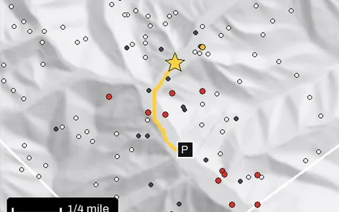 How deer notice you checks your scent, sound and sight against the modeled deer through your walk in, your sit and your walk out.How a deer notices you →
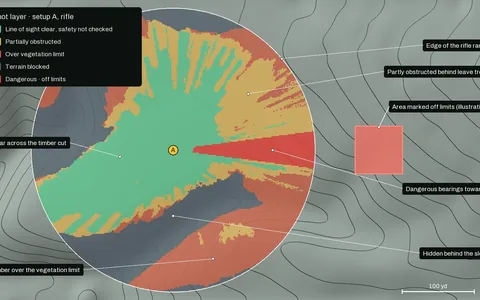 The shot maps line of sight, range, angle and what lies beyond from each setup.The ethical shot →
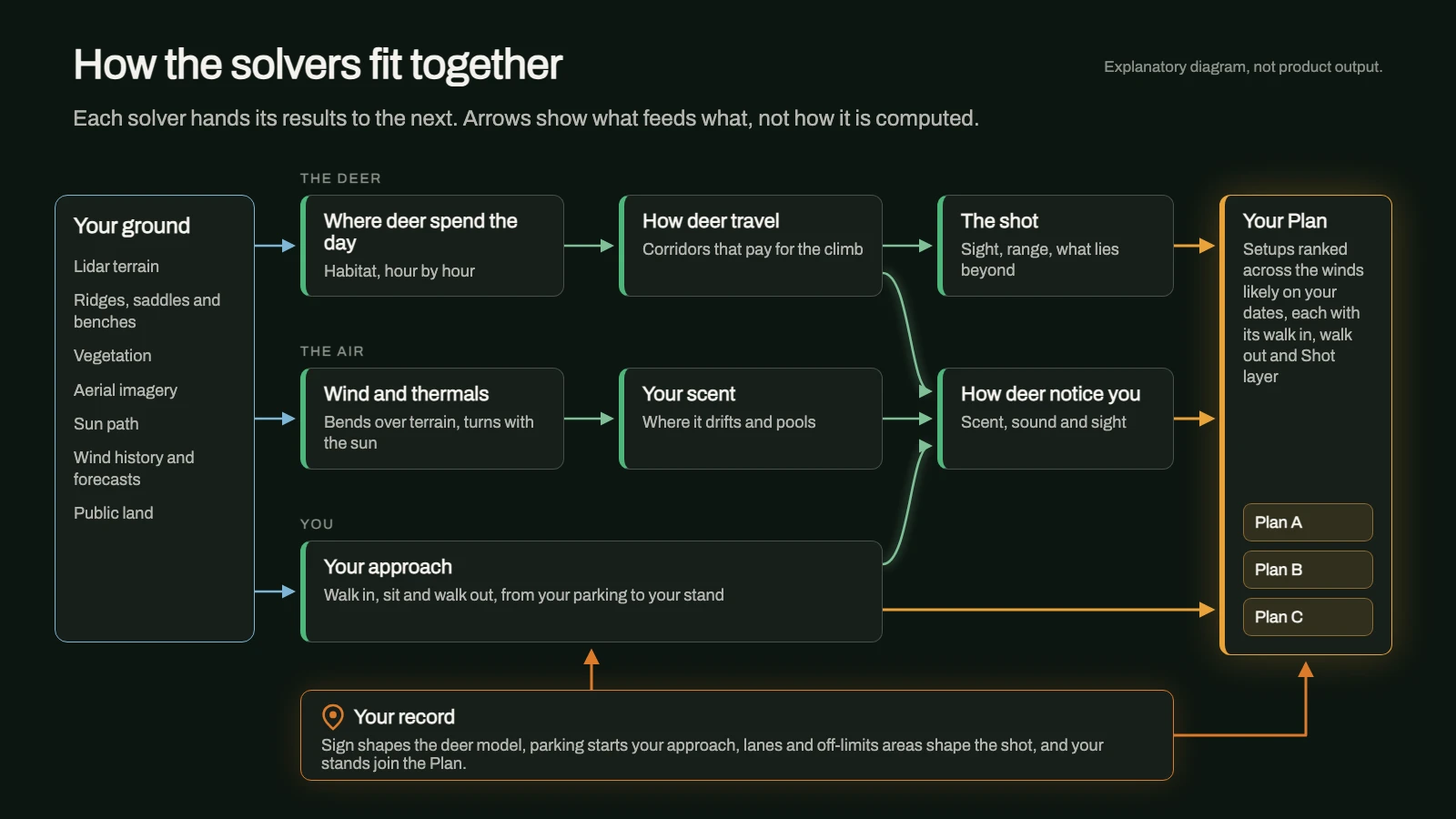
A Plan, ranked by the solvers
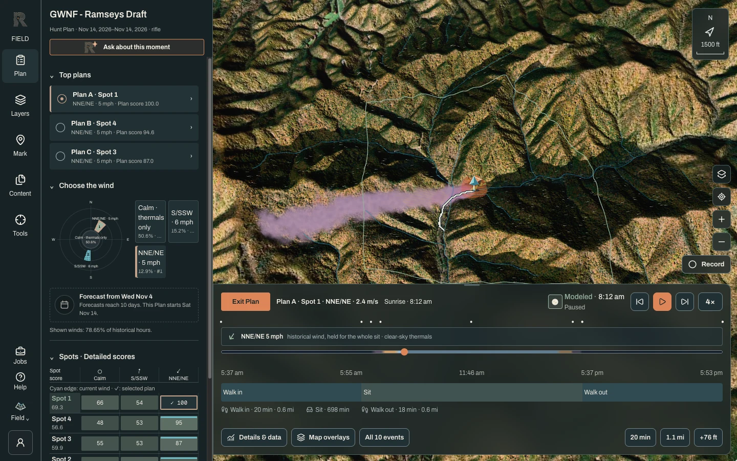
Plan a Hunt asks for your dates, weapon, foliage and where you park. Reckonar then compares many possible setups with the solvers above and keeps a few strong ones. Each comes with its walk in and walk out, its Shot layer and how it holds up in each wind that is likely on your dates. Scores rank setups on the same ground against each other. They are not odds of seeing a deer.
The AI reasons, it does not measure
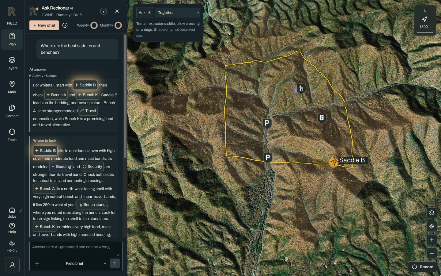
Ask Reckonar is where the AI comes in. It reads the solvers’ results, your saved Plans and your record, and weighs them against expert whitetail scouting principles to answer questions in plain language. Ask it why one setup beats another or what changes if the wind swings, and it explains its reasoning. Every figure it quotes traces to a solver, a saved Plan or something you recorded. Ask Reckonar: where its answers come from covers it in detail.
Your record makes it yours
Marks are how you teach Reckonar your ground. Stands, cameras, sightings, rubs and scrapes, bedding, food, water, parking, shooting lanes and off-limits areas all count. Plans start from your parking, weigh your own stands, respect your lanes and off-limits areas, and sign you mark adjusts the deer model. Ask reads all of it, and the more you record, the more specific its answers can be. Share a Hunt Area with your Camp and everyone’s marks count.
What we don’t claim yet
- The solvers are implemented and run on every Plan, and automated tests cover parts of their physics and geometry. Sun and legal-light times are checked against the U.S. Naval Observatory, and the shot’s terrain line of sight against an independent GIS tool.
- No deer-behavior model has been checked against real deer movement yet, and scores have never been compared with hunt outcomes. Layers are relative, not deer counts.
- Vegetation maps miss understory and small openings, so walk the ground before you trust a lane.
- Reckonar has no live animal data, by design.
Where to find it in Reckonar
Draw a Hunt Area in Scout, open it in Field for the 3D ground and its Layers, use Plan for Plan a Hunt and Ask Reckonar, and Mark to add your record.